


Maps were Important to North Carolina Pioneers
northcarolinapioneers.com
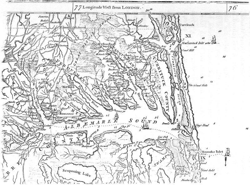
Maps are essential to finding the ancestors. Thus, when you find an old map, such as the displayed Mouzon Map, events of the times begin to unfold.
The Albemarle Sound region is a detail from a famous 1775 map of North and South Carolina by Henry Mouzon, Jr. It was printed in England and reproduced slightly smaller than the original.
American, British, and French forces used this map. That is how valuable it was.
One might imagine himself as a Revolutionary War general, studying the little towns, ports, and roads that meander through the countryside. In those days, each little town with its hills and dales had its military importance or how it might be protected or destroyed.
The surveyor, Claude Joseph Sauthier, created beautiful maps of ten North Carolina towns. The Hillsboro map (below) is one of these drawings.
Sauthier traveled over North Carolina from 1768 to 1770, surveying and making maps of Bath, Beaufort, Brunswick, Edenton, Cross Creek (now Fayetteville), Halifax, Hillsboro, New Bern, Salisbury, and Wilmington. These drawings were commissioned by then Governor Tryon of North Carolina and were recorded in the British Museum in London.
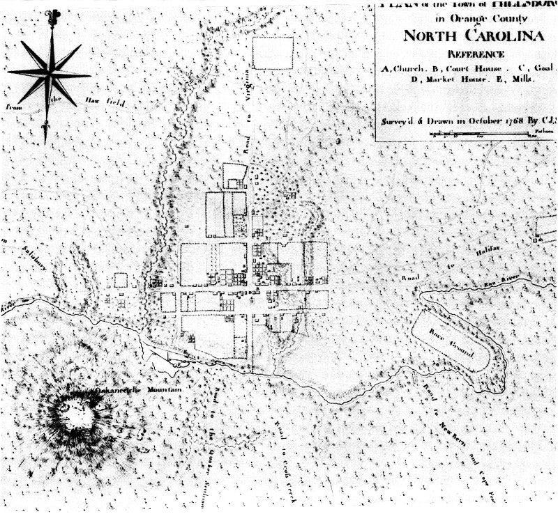
Sauthier traveled over North Carolina between 1768 and 1770, surveying and making maps of Bath, Beaufort, Brunswick, Edenton, Cross Creek (now Fayetteville), Halifax, Hillsboro, New Bern, Salisbury, and Wilmington. The drawings were commissioned by Governor Tryon and sent to the British Museum in London.

https://northcarolinapioneers.com
LInk to same map on David Rumsey. https://www.davidrumsey.com/luna/servlet/detail/RUMSEY~8~1~1919~120025:Map-Of-North-And-South-Carolina-Wit?sort=Pub_List_No_InitialSort%2CPub_Date%2CPub_List_No%2CSeries_No&qvq=q:mouzon%20north%20carolina;sort:Pub_List_No_InitialSort%2CPub_Date%2CPub_List_No%2CSeries_No;lc:RUMSEY~8~1&mi=1&trs=5